
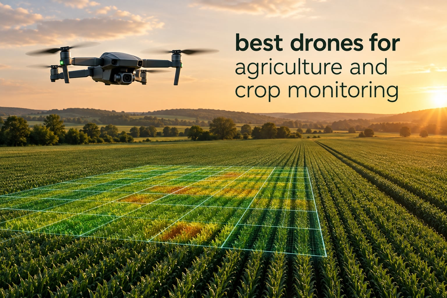
Choosing the best drones for agriculture and crop monitoring starts with a distinction most roundups get wrong: spraying machines and imaging machines are not the same purchase. A sprayer carries a tank, a pump and atomising nozzles, and it legally counts as an agricultural aircraft the moment anything leaves the tank. An imaging drone carries a camera and exists to tell you where in the field to walk, spray or irrigate. This roundup covers the second group, and it covers it honestly.
None of the eight platforms below dispenses anything. What they share is the ability to fly a repeatable survey line, capture imagery a mapping package can ingest, and hand you a field boundary polygon and a stress map at the end of the flight. Three of them add a radiometric thermal payload for irrigation and disease work. One is a fixed-wing agricultural airframe sold without its multispectral camera, which is an important detail rather than a footnote.
I have read the review data on every airframe here, compared the sensor stacks, endurance figures and transmission ranges side by side, and separated the two things buyers consistently confuse: what the aircraft can capture, and what you can actually do with the result. On r/farming, the most common report from growers is not about spraying at all. One user described a basic setup as “great to check for crop damage, standing water and plant progress,” and called the time saving the main return. That is the use case this list is built for.
If you want the broader picture first, our guide to the best surveying drones covers the mapping workflow in more depth, and the FPV racing drone roundup explains why a racing airframe is the wrong tool for anything that has to repeat the same line twice.
Table of Contents
Quick Picks for the Best Drones for Agriculture and Crop Monitoring in 2026
DJI Mavic Air 2 Fly More Combo – best overall scouting drone, huge review base, three batteries
DJI Air 3 Fly More Combo – best value pick with the longest transmission link in the group
DJI Mavic 3 Classic – best for long single-battery passes and repeatable waypoint missions
Autel EVO II Dual 640T V3 – best thermal payload for irrigation scheduling and hot-spot work
Autel EVO II Dual 640T Enterprise V3 – best expandable platform if RTK arrives later
Autel EVO Lite 640T Enterprise – best lightweight thermal drone for single-pilot backpack work
DJI Mavic 2 Pro Enterprise Bundle – cheapest credible way into 1-inch sensor mapping, read the listing carefully
Parrot Disco-Pro AG – best fixed-wing agricultural airframe, sold here without its camera
Top 3 Best Drones For Agriculture And Crop Monitoring (October 2026)
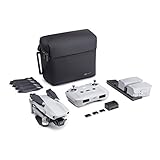
DJI Mavic Air 2 Fly More Combo
- 48MP 1/2-inch CMOS stills
- 34 minutes flight time
- 3 batteries included
- 10 km OcuSync 2.0 link

DJI Air 3 Fly More Combo
- Dual wide and 3x telephoto cameras
- 20 km transmission
- 48MP stills
- Omnidirectional obstacle sensing

DJI Mavic 3 Classic
- Hasselblad 4/3 CMOS 20MP RAW
- Up to 46 minutes flight time
- Waypoint Flight repeats routes
- 15 km transmission
Every Drone in This Roundup Side by Side in 2026
All eight platforms below are imaging and scouting machines, not spray platforms. Read the sensor column first, because it decides whether the aircraft can produce an NDVI-style index or only a colour map.
| Product | Specifications | Action |
|---|---|---|
| DJI Mavic Air 2 Fly More Combo |
|
Check Latest Price |
| DJI Air 3 Fly More Combo |
|
Check Latest Price |
| DJI Mavic 3 Classic |
|
Check Latest Price |
 Autel EVO II Dual 640T V3 Autel EVO II Dual 640T V3 |
|
Check Latest Price |
 Autel EVO II Dual 640T Enterprise V3 Autel EVO II Dual 640T Enterprise V3 |
|
Check Latest Price |
 Autel EVO Lite 640T Enterprise Autel EVO Lite 640T Enterprise |
|
Check Latest Price |
 DJI Mavic 2 Pro Enterprise Bundle DJI Mavic 2 Pro Enterprise Bundle |
|
Check Latest Price |
 Parrot Disco-Pro AG Parrot Disco-Pro AG |
|
Check Latest Price |
1. DJI Mavic Air 2 Fly More Combo – Best All-Rounder for Field Scouting
DJI Mavic Air 2 Fly More Combo – Drone Quadcopter UAV with 48MP Camera 4K Video 8K Hyperlapse 1/2″ CMOS Sensor 3-Axis Gimbal 34min Flight Time ActiveTrack 3.0 Ocusync 2.0, Gray
48MP 1/2-inch CMOS
34 min flight time
10 km OcuSync 2.0
1.3 lb airframe
Pros
- 48MP stills and 4K/60fps HDR video
- Holds stable hover in gusty wind
- Three-direction obstacle sensing aids new pilots
- Three batteries give roughly 23 to 27 minutes per pack
- ND16/64/256 filter set and three-bay charging hub
Cons
- No FPV goggles support out of the box
- No built-in waypoint mode or SDK for repeatable survey apps
- 4K/60fps unavailable in tracking modes
- Bundled case offers limited protection
This is the drone I would hand to a grower who has never flown before and whose fields are mixed small blocks rather than long open rectangles. The Mavic Air 2 weighs 1.3 pounds and folds down to 7.09 by 3.82 by 3.31 inches, so it moves from the truck bed to a field gate without a case that eats a third of the pickup bed.
What makes it work for scouting is the 48MP 1/2-inch CMOS Quad Bayer sensor on a 3-axis mechanical gimbal. At typical mapping altitude, that resolution gives you enough ground sample distance to separate individual plants in a row crop, and the DNG output means you are not locked into a baked JPEG. The ND16, ND64 and ND256 filters in this bundle matter more for crop work than most buyers realise, because they let you hold shutter speed in bright midday sun without burning out canopy reflectance data.
Owners consistently report stable flight even when gusts reach roughly 30 mph, and the three-direction obstacle sensing covers front, back and bottom. That combination is what makes repeated survey lines possible for someone who is still learning how to fly. Reviewers also note the OcuSync 2.0 link holds a stable 10 km transmission with a 1080p live feed, which is generous for field use.
The Fly More Combo is the reason this is my top pick. Three intelligent flight batteries and a three-bay charging hub mean a morning of flying without a generator, and reviewers commonly describe 23 to 27 minutes of real Sport Mode flight per pack, which is a large slice of a typical scouting window. Owners also praise the ActiveTrack 3.0, Spotlight 2.0 and POI 3.0 modes for lining up repeat shots of a stress patch from the same position.
Now the honest limitations. There is no FPV support out of the box, and there is no built-in robust waypoint mode or third-party SDK, so repeatable survey missions depend on third-party apps rather than the native flight software. If your workflow requires the exact same line flown every fortnight, that is a real gap. 4K/60fps also switches off in the tracking modes, and a single IMU and compass is a known reliability risk over water.
What you can actually map with it?
At 400 to 600 feet with overlap set in a mapping app, the 48MP mode gives you detailed colour orthomosaics suitable for irrigation leak spotting, standing-water detection and stand counting in emerged crops. The gimbal stabilisation means the frames stay level even when the aircraft is correcting drift, which is where cheaper fixed-gimbal platforms lose you usable imagery.
What it cannot do is generate a true red-edge vegetation index on its own. The Mavic Air 2 records blue, green, red and near-infrared only, so software can compute NDVI but not NDRE, and dense mature canopies will saturate. For early-season scouting and general field documentation that is plenty. For chlorophyll-level work in a closed canopy, you need a different platform.
Where it falls short?
The 48MP mode only exceeds the 12MP mode in ideal lighting, so on an overcast morning or at dusk you are paying for pixels you are not using. The included carrying case is modest, and reviewers with more than a season of use describe it as better suited to a car boot than a truck bed in rough terrain.
For a reader comparing this to a dedicated survey aircraft, note that it has no RTK. Position accuracy comes from the standard GNSS solution, so your mapped products are good for zone-level decisions rather than centimetre-level plot boundaries. That is fine for directing a grower to a zone. It is not fine for regulatory record-keeping or trial plot work.
2. DJI Air 3 Fly More Combo – Best Value for Long Field Passes
DJI Air 3 Fly More Combo with DJI RC 2, Drone with Camera 4K, Dual Primary Cameras, 3 Batteries for Extended Flight Time, 48MP Photo, 20Km Max Video Transmission, FAA Remote ID Compliant
Dual wide plus 3x telephoto
20 km transmission
48MP stills
720 g with 3 batteries
Pros
- Wide and 3x telephoto framing from one aircraft
- 48MP stills hold detail when cropped
- Omnidirectional obstacle sensing over trees and terrain
- Three-battery combo extends a field day
- RC 2 controller has a built-in screen
Cons
- No multispectral or thermal payload of any kind
- No RTK for survey-grade positional accuracy
- DJI Fly app is no longer on Google Play
- RC 2 is bulky in the field
The Air 3 solves one specific problem well: getting both a wide scene and a tight detail shot without landing and swapping aircraft. The dual primary camera system pairs a wide-angle lens with a 3x medium telephoto, so you can fly a block, spot a problem, and capture a close view of it in the same battery.
At 720 g it is among the lightest airframes here, and the six-antenna array holds a stable 1080p/60fps feed out to 20 km, which is the longest transmission range in this group. Omnidirectional obstacle sensing is a genuine upgrade over the three-direction package on the Mavic Air 2, and over orchard canopies and rough ground that difference is what keeps a survey line intact.
The DJI RC 2 controller includes a built-in screen, so there is no phone in the loop and no glare problem on a bright field day. With three batteries and a charging hub in the box, a grower covering several hundred acres in a morning is not waiting on batteries. It is also FAA Remote ID compliant, which matters once you start operating beyond visual line of sight margins in structured airspace.
Reviewers commonly highlight the dual-camera versatility and the safety sensing as the two things that carry the platform. One recurring operational note on the Air 3 and its siblings: the DJI Fly app has been removed from Google Play, so you download it from DJI directly. Plan for that before you are standing in a field with no signal and no app.
Here is the honest caveat. There is no multispectral or thermal payload available for this airframe, and no RTK, so every product you build is a colour orthomosaic with a normal GNSS position solution. That is enough for irrigation scheduling by eye, crop progress tracking and damage assessment, which is exactly what growers on r/farming describe as the daily value. It is not enough for a nutrient deficiency map you intend to variable-rate off.
Where the dual camera earns its place?
The 3x telephoto is the part agricultural buyers underrate. Once a colour map flags a stressed corner, you can hover and fill the frame with a 48MP crop of the affected plants, which is the difference between a scout confirming a problem and a scout guessing at one. The 48MP stills hold usable detail after that crop.
It also suits mixed work. If your operation includes fence-line inspection, roof survey or herd checking alongside crop work, the dual camera removes the need for a second aircraft, and the surveying drones guide covers where that combination stops being enough.
Where it falls short?
The RC 2 is bulky in the field, which adds up across a full day of walking blocks. Because the standard GNSS solution carries no RTK correction, the mapped output cannot support plot-level or trial-grade boundaries, and there is no third-party sensor option to change that. For anyone whose decision is specifically about variable-rate application, this airframe simply cannot make the decision.
3. DJI Mavic 3 Classic – Best Endurance and Waypoint Repeats
DJI Mavic 3 Classic (DJI RC), Drone with 4/3 CMOS Hasselblad Camera, 5.1K HD Video, 46 Mins Flight Time, Omnidirectional Obstacle Sensing, Smart Return to Home, FAA Remote ID Compliant
Hasselblad 4/3 CMOS 20MP
Up to 46 minutes flight
Waypoint Flight
895 g
Pros
- 4/3 CMOS Hasselblad camera with RAW stills
- Handles 40 mph wind confidently
- Real flight time of 38 to 46 minutes per battery
- Waypoint Flight supports repeatable survey routes
- Omnidirectional sensing with APAS 5.0
Cons
- DJI RC controller is slow and lags on input
- Airframe is large and needs a hard case
- Extra batteries cost a lot
- HDR bracketed photos are only about 0.7 EV apart
Endurance is the number buyers compare first once the sensor question is settled, and the Mavic 3 Classic is the longest-flying aircraft in this roundup. DJI rates it at up to 46 minutes of flight time, or 40 minutes hovering, and reviewers report real numbers in the 38 to 46 minute range. That is a meaningful difference when you are paying a technician to walk three blocks an afternoon.
The Hasselblad L2D-20c carries a 4/3 CMOS sensor with 20MP effective resolution and RAW capture in DNG, plus 5.1K video at up to 50 fps and 4K/120fps slow motion. A 4/3 sensor gathers more light per pixel than the 1/2-inch and 1-inch sensors elsewhere in this list, and for a grower working early mornings or overcast conditions that is the difference between usable reflectance data and noise.
More important for repeat work is Waypoint Flight, which stores and repeats routes. Combined with Advanced Return to Home and AR route synchronisation, you can fly the same line over the same block every fortnight and compare the results directly. Omnidirectional obstacle sensing with APAS 5.0 covers all directions rather than three.
Several owners report a year-plus of reliable commercial use on this platform, and reviewers frequently single out wind tolerance in the 40 mph range as the reason their lines did not break up. The 5.5-inch HD screen on the RC controller is readable in sunlight, which is a small thing that matters across a long day outdoors.
The 895 g airframe is heavier than the Air 3 and larger than the Mavic Air 2, and reviewers note it needs a separate hard carrying case. That is a real cost for anyone moving between scattered fields. Owners also flag the bundled controller as slow, with input lag and limited Android app support, and several mention that the HDR bracketed photos are only about 0.7 EV apart, which limits how much detail you recover from a high-contrast canopy.
The same RTK and multispectral limits apply as with the other DJI consumer platforms in this roundup. There is no thermal, no multispectral and no RTK option, so this remains a colour-mapping machine. What it does have that the others lack is the combination of a large sensor and long endurance, which means fewer batteries and fewer landings per block.
Why the extra flight time changes the economics?
Coverage is not a headline spec, it is flight time divided by the time it takes to fly a line at your required overlap and resolution. Longer batteries mean fewer battery swaps, fewer takeoffs in a headwind, and fewer landings where a partially completed line gets abandoned halfway. For anyone charging per acre for survey work, that is a direct margin line rather than a comfort feature.
The Waypoint Flight function is the second lever. If the route is repeatable, a scouting pass becomes a comparison between two dates rather than a fresh hunt, and the agronomist reading the output can look at change rather than at a single snapshot.
Where it falls short?
The controller lag is the complaint that comes up most and the one that cannot be fixed with a firmware update. Extra batteries are expensive, and at 895 g the airframe is too large to carry comfortably on long transits. Sport mode disables the omnidirectional sensors, which is a sensible safety trade but worth knowing before you reach for it in a hurry.
4. Autel EVO II Dual 640T V3 – Best Thermal Payload for Irrigation Work
Autel Robotics EVO II Dual 640T V3, 640×512 Thermal Imaging Drone, RemoteID
640x512 thermal at 30 fps
50 MP RYYB visible
38 min flight
360-degree avoidance
Pros
- Thermal sensor with multiple palettes and measurement modes
- 50 MP visible sensor produces highly detailed imagery
- Picture-in-picture thermal overlay on the visible view
- Stable hover and accurate landing
- Obstacle avoidance and return behave reliably
Cons
- Non-Enterprise model cannot take strobe spotlight speaker or RTK modules
- Extended coverage plans sold separately
- One owner reported a thermal module failure within a year
- Case camera cover vent is a weak point
This is the first aircraft in the list with a payload that measures something other than reflected light. The 640×512 thermal sensor runs at 30 fps through a 13mm lens with 16x digital zoom, and the visible side is a 0.8-inch RYYB CMOS at 50MP with 8K still capture. Thermal and visible on one airframe is what separates a real crop monitoring workflow from a colour camera pointed at soil.
For irrigation work, the temperature tools are the point: spot, regional and central temperature measurement, more than ten thermal palettes, an isotherm overlay and a temperature alarm. The picture-in-picture mode puts the thermal view directly against the visible view, so you can confirm a hot spot is irrigation and not a bare patch of soil before you drive out to it.
Flight time is 38 minutes, and 360-degree obstacle avoidance runs off a 19-sensor array with 12 visual sensor groups, which also feeds real-time 3D mapping and path planning. SkyLink 2.0 runs tri-band across 2.4, 5.8 and 900 MHz out to 15 km at up to 2.7K, and that tri-band anti-interference design is a genuine advantage in orchard country with heavy radio noise. The 7.9-inch Smart Controller V3 is bright enough to work in direct sun.
Reviewers in wildlife management and inspection, which share most of the thermal workflow with crop work, describe the setup as accurate and versatile, and several single out Autel’s support responsiveness. One buyer had a warranty replacement handled smoothly, which matters when the airframe is a working tool rather than a weekend toy.
The number to read honestly is the 4.0 average across 53 reviews, with 13 percent one-star. That is well below the DJI platforms here, and the reasons are specific: this non-Enterprise model cannot accept Autel’s modular accessories, so there is no path to RTK, and extended coverage plans are sold separately at added cost. One owner reported a thermal module failure inside a year and a warranty refusal on a water-damage claim. Treat that as a single data point rather than a pattern, but plan for the possibility.
The rating spread also carries a message about expectations. A thermal drone is a specialist instrument. If you bought it expecting a nice aerial video platform, the 4.0 will feel personal. If you bought it to find irrigation problems, the same reviews read differently.
What thermal adds that colour cannot?
Colour imagery shows you where plants look different. Thermal shows you where they are losing water, which means you can find a blocked emitter or a dry patch while the canopy still looks green to a walking scout. That is the single most reliable use of thermal in row crops, and it is why irrigation scheduling is where this platform pulls its value.
The other reliable use is early disease detection, because a plant under pathogen stress changes temperature before it changes colour. The measurement modes on this aircraft are what make that usable: a regional average tells you whether a whole zone is warmer than its neighbours, and the temperature alarm flags the outliers so you do not have to fly the block twice.
Where it falls short?
The missing modular path is the main limitation. On the non-Enterprise version, no RTK, no strobe, no spotlight and no loudspeaker, so when you outgrow a zone-level thermal survey there is nowhere to go without changing aircraft. The bundled case has a camera cover vent that reviewers flag as a weak point that can crack.
And the honest one: 640×512 is a modest thermal resolution. It will find a hot zone across a block. It will not resolve individual plants at canopy level, so it complements a high-resolution multispectral payload rather than replacing one.
5. Autel EVO II Dual 640T Enterprise V3 – Best Expandable Thermal Platform
Autel Robotics EVO II Dual 640T Enterprise V3, 640 * 512 T~hermal Imaging
640x512 thermal with 16x zoom
42 min flight
Modular accessories
1136 g
Pros
- Thermal payload handles multiple temperature measurement modes
- 7.9-inch controller readable in direct sun
- 42-minute endurance gives longer survey blocks
- Tri-band transmission holds a stable link
- Enterprise variant accepts strobe spotlight speaker and RTK
Cons
- Only 11 reviews so durability data is thin
- RTK module not included in this bundle
- Heavier 1136 g airframe than the Lite series
This is the same thermal core as the EVO II Dual, built on the Enterprise chassis, and the difference is entirely about what you can add later. The Enterprise variant accepts strobe, spotlight, loudspeaker and an RTK module, so this is the version that makes sense if you know you will eventually need survey-grade positional accuracy.
Endurance improves to 42 minutes on larger propellers and extended carbon fibre arms, which is four minutes more than the standard model and gives you the longest thermal flight time in this roundup. The visible camera still reaches 50MP with 8K video capture, and the thermal sensor keeps the 640×512 resolution, 13mm lens and 16x zoom, with isotherm and image enhancement alongside the spot, regional, central and alarm measurement modes.
Two other details matter in the field. The operating range is minus 10 to 40 degrees C, wider than you get on a lot of airframes, and SkyLink 2.0 holds 15 km at up to 2.7K across three bands. The 7.9-inch Smart Controller V3 with four times typical screen brightness is the same unit reviewers praise for sunlight readability.
The 4.8 rating is the highest in this group, with 78 percent five-star and no rating below three stars. Buyers single out the thermal detail, the screen brightness, the endurance and the expandability. What they cannot tell you is durability over a season, because 11 reviews is a very thin base for a working agricultural platform.
So the sensible way to read this rating is as an early signal rather than a verdict. A high score on a small sample tells you the platform does what the brochure says when new. It does not tell you how it behaves after two hundred flights, and nobody has posted that yet. The first four platforms in this roundup, with review bases in the hundreds and thousands, are the safer place to gather long-term reliability evidence.
The same caution applies to the RTK module. It is described as available rather than included, so budget for it as a separate purchase if you need it, and confirm with the dealer what the module does to the airframe weight and flight time before committing.
Whether the modular path is worth planning around
The value of a modular platform is that you are not forced to choose a payload on day one. If this season is irrigation work, fly it with the thermal payload. If next season is trial plot or boundary documentation, add RTK and the same airframe handles it. That flexibility is the whole argument for this model over the standard EVO II Dual.
It also matters for a specific failure mode: if you later need a spotlight for night herd or perimeter work, or a loudspeaker, you are not buying a second aircraft to get them.
Where it falls short?
Eleven reviews is the honest headline, and it is why this is not the top pick despite the 4.8 score. The 1136 g airframe is heavier than the Lite series and larger to transport, and RTK is not in the box. Anyone buying this as a first agricultural platform is accepting a thinner support and reliability record in exchange for the upgrade path.
6. Autel EVO Lite 640T Enterprise – Best Lightweight Backpack Deployer
Autel Robotics EVO Lite 640T Enterprise Bundle, 866g Lightweight
640x512 thermal at 30 Hz
Temperature range minus 20 to 550 C
866 g folded
40 min flight
Pros
- Lightest thermal airframe here at 866 g with a compact fold
- Very wide minus 20 to 550 C temperature range
- 48 MP 1/2-inch CMOS for field documentation
- AI target recognition projects 100+ targets onto a map
- Enterprise app supports single-pilot missions
Cons
- Only 7 reviews with a 4.1 average and a third at three stars
- No built-in screen on the included Remote Controller SE V2
- Smaller 9mm thermal lens than the EVO II Dual
Weight decides whether a thermal survey happens at all, and at 866 g folded down to 210 by 123 by 95 millimetres this is the one you can carry a kilometre into a field and launch without a vehicle parked at the gate. For fragmented holdings with small separated blocks, that is not a convenience, it is the difference between surveying them and not surveying them.
The thermal sensor is 640×512 at 30 Hz through a 9mm lens with 16x digital zoom, and the temperature measurement envelope runs from minus 20 to 550 degrees C at plus or minus 3 degrees accuracy. That range is far wider than crop work needs, but it is the specification reviewers mention most often, and the accuracy figure is the one that matters for irrigation decisions.
The visible camera is a 1/2-inch CMOS at 48MP with 16x digital zoom, so you get a documented colour record alongside the thermal pass. Flight time is 40 minutes, and SkyLink 2.0 runs dual-signal dual-reception out to 12 km. The AI target recognition projects 100 or more recognised targets onto a digital map in real time, which is built for herd and perimeter work as much as for crop scouting.
The 4.1 average from 7 reviews deserves a direct reading: 46 percent five-star, 33 percent three-star, and no one- or two-star ratings at all. Nobody is reporting failures. They are reporting mixed expectations, most likely on image quality, which is what you would expect from a 9mm lens paired with a 1/2-inch visible sensor at a very small airframe size.
The included Remote Controller SE V2 has no built-in screen, so you are flying with a phone or tablet. That is a downgrade from the Smart Controller V3 on the two EVO II models, and in bright sun it is the part of the kit most likely to frustrate you. If you are buying this platform, budget for a higher-brightness controller or a shade.
When a lighter airframe pays for itself?
Consider a grower with a dozen small parcels spread along a road rather than one contiguous block. With a heavier aircraft, you drive between parcels, set up, pack up, and the labour cost per flight eats the value of the data. With an 866 g backpack-deployable airframe, one person can walk in, launch, capture, and walk out, and the survey becomes something you do weekly instead of once a season.
That is the honest argument for this model, and it is a workflow argument rather than a specification argument. The thermal payload here is comparable to the EVO II on paper. The reason to pick it is how you get to the field.
Where it falls short?
Seven reviews is not a reliability record, and the 9mm lens is narrower than the 13mm on the EVO II Dual, so it sees a tighter scene per pass. The screenless controller is the most common practical complaint. And with 866 g of airframe carrying a thermal payload, this is a working tool, not something you would fly casually.
7. DJI Mavic 2 Pro Enterprise Bundle – Cheapest Credible Mapping Entry
DJI Mavic 2 Pro Enterprise Bundle
Hasselblad 1-inch CMOS 20MP
31 min flight
44 mph max speed
Third-party bundle
Pros
- 1-inch 20MP Hasselblad sensor captures high-detail stills
- Omnidirectional obstacle sensing on a proven airframe
- 31 minutes flight time and 44 mph top speed fit larger passes
- Bundle includes 32 GB card reader and PGYTECH accessories
Cons
- Two verified one-star reviews say the shipped airframe is not the Enterprise model
- Bundle assembled and branded by a third-party seller
- Older generation with no thermal multispectral or RTK options
- Only 5 reviews to judge reliability
The sensor is the argument here. A 1-inch CMOS behind a Hasselblad L1D-20c at 20MP gathers meaningfully more light per pixel than the 1/2-inch sensors in the cheaper consumer drones, and the adjustable aperture plus HDR photos give you control over a high-contrast canopy scene. That is the capability a mapping workflow needs most.
Flight time is 31 minutes with a 44 mph maximum speed, and omnidirectional obstacle sensing on a mature airframe keeps survey lines clean. Storage is 8 GB internal plus SD up to 128 GB. The bundle adds a PGYTECH accessory package, a 32 GB microSD card and a USB reader, which is a real saving on setup if you were buying those separately.
But read the listing carefully, and this is the single most important sentence in this review. Two verified one-star reviews state that the airframe they received is not the Enterprise model shown in the listing imagery. The bundle is assembled and branded by a third-party seller rather than sold by DJI, which means what arrives depends on what the seller put in the box that week.
With 5 reviews and a 4.0 average, split between 49 percent five-star, 35 percent four-star and 16 percent one-star, this listing’s main risk is administrative rather than mechanical. The one-star reviews are about listing accuracy, not flight performance, and those are the reviews worth reading first.
The second issue is generational. This is an older platform with no thermal, no multispectral and no RTK path. If your plan is colour orthomosaics for scouting and documentation, that is a genuine capability for the money. If your plan is vegetation indices, you are starting a platform you will outgrow. Note also that the 4.0 rating sits in the same band as the Autel EVO II Dual standard model, which does carry a thermal payload, so compare the two on the work you need rather than the rating alone.
On the forum side, the practical advice that keeps coming up for new agricultural operators is to buy the simplest platform that covers your acres and spend the difference on training and a qualified pilot. This listing is a legitimate way to get into 1-inch sensor mapping, provided you confirm the exact airframe on arrival.
How to verify what actually arrives?
Check the model number on the airframe and in the firmware against what the listing claims, and confirm the accessories are the ones described. Do it with the aircraft on the ground, powered, before any flight. If the delivered configuration does not match the listing, that is a returns question and it is far easier to raise on day one than after a season of work.
For anyone who flies a lot of the same blocks, this is also the point to weigh a newer airframe instead. A one-inch sensor on an older platform is a good camera on old electronics, and the mapping workflow is where the money goes, not the camera alone.
Where it falls short?
Third-party assembly, an older generation, no sensor upgrade path, and a 5-review base. That combination makes this the entry point rather than a destination, and the right question is whether you would rather spend the difference on the Enterprise V3 thermal platform later or keep the outlay low now.
8. Parrot Disco-Pro AG – Purpose-Built Agricultural Airframe, Camera Sold Separately
Parrot DISCO-PRO AG Without Sequoia
Fixed-wing agricultural platform
Compact folding wing
Sequoia camera not included
Listed since 2018
Pros
- Purpose-designed as an agricultural mapping platform not a repurposed hobby drone
- Compact fixed-wing form factor covers acreage efficiently per battery
Cons
- This variant does not include the Sequoia multispectral camera
- One owner reported total power loss into a pond with warranty refused
- Parrot support described as unresponsive
- Only 4 reviews at a 3.6 average including 20 percent one-star
- Listing dates from March 2018 with no recent updates
This is the only purpose-built agricultural airframe in the roundup. Every other platform here started life as a camera or enterprise drone and gained agricultural relevance; the Disco-Pro AG was designed for mapping from the beginning, and a fixed-wing form factor is more efficient per battery on a straight, long field than any multirotor of comparable size.
That is the real advantage. A multirotor holds position and consumes most of its battery doing so, while a fixed wing spends its time covering ground. On long, straight, open blocks with no obstacles, a fixed wing can cover substantially more area per flight, which is the economics that decide whether survey work is viable.
Now the detail that matters more than any specification on this page: this variant does not include the Sequoia multispectral camera. The Sequoia is the sensor that makes an agricultural platform able to compute vegetation indices, and without it you have an aerial mapping airframe with no agricultural sensor at all. Check the configuration before you buy, not after.
The 3.6 average from 4 reviews is the lowest in this roundup, and the reasons are not subtle. One owner reported a total power loss and a fall into a pond, with Parrot declining to replace it under the liquids precaution in the manual. Parrot support was described as unresponsive and unwilling to stand behind failures. The listing dates from March 2018, which tells you what you need to know about update activity.
None of that changes the fact that the airframe design is right for the job. It changes the risk profile entirely, and it is the reason this sits at the end of the list rather than somewhere on merit. A 2018 platform with a camera stripped out and no current support is a parts and reliability question, not a specification question.
If you are researching fixed-wing agricultural mapping, treat this as a design reference rather than a purchase. Compare its coverage-per-battery logic against the multirotors above, and if you are looking at monitoring rather than spraying, note that our indoor security camera guide covers the fixed-camera monitoring side of farm security, which is a different problem with different hardware.
What the fixed-wing design teaches you?
Compare a fixed wing and a multirotor on the same block and the arithmetic is simple. A multirotor spends most of its endurance translating forward and holding position against wind. A fixed wing flies the line continuously. On a straight field with a safe launch and recovery area, that is the argument for a wing.
What you give up is flexibility. A wing cannot hold a point for a close inspection, cannot work in fragmented terrain without a clear launch corridor, and in anything resembling an orchard it is impractical. That is why none of the multirotors above can be replaced by one airframe.
Where it falls short?
No camera in this configuration, no recent updates, a 4-review base, and a documented support failure. The efficiency argument is sound; the product risk in this particular listing is not. If a fixed wing interests you, look for a platform with current parts supply and a support record before committing.
How to Choose an Agriculture Drone in 2026?
Sensor type is the first filter, and it is the only one that cannot be changed later. Colour sensors map irrigation problems, standing water, erosion and crop progress. Thermal sensors measure surface temperature for irrigation scheduling and early disease detection. Multispectral sensors with a red edge band compute NDRE and chlorophyll indices in dense mature canopies, which is the only one of the three that reaches the limit of what vegetation index analysis can tell you. Pick the one your crops and season actually require.
Endurance and coverage come next, and the useful number is not flight time. Coverage is roughly flight time multiplied by line width, divided by the time needed to fly that line at your required overlap. A 46-minute aircraft that flies one long pass beats a 38-minute aircraft that flies three short ones on the same field, because takeoffs and landings are where time and error accumulate. Reviewers consistently report real flight time below the rated figure, so plan on the lower end.
Repeatability decides whether you can compare two dates. Waypoint Flight on the Mavic 3 Classic stores and repeats routes, and route synchronisation on return to home makes the whole flight reproducible. The cheaper consumer platforms rely on third-party apps, which work but add a step. If your decision model depends on change detection between passes, repeatable routes are not optional.
Position accuracy splits the field in two. Without RTK, your products are good for directing attention to a zone. With RTK, you can produce boundaries defensible enough for record-keeping, trials and regulatory evidence. Two of the Autel platforms here accept an RTK module; none of the DJI consumer airframes in this roundup do.
Software is the recurring cost and the most common complaint. Data interpretation is the real bottleneck, not hardware, and forum users report collecting data they cannot act on without agronomy support. Before buying anything, confirm your output exports to the farm management system you already run in a format you can keep. DJI Terra and Agisoft Metashape dominate this list’s workflows, and our coverage of the FPV drone workflow touches the same software-ecosystem question from a different angle. A platform that only exports to one vendor’s cloud is a long-term commitment.
Regulatory requirements are non-negotiable and often missed. In the US, Part 107 certifies commercial operation, and Part 137 is the additional agricultural aircraft rule set that applies the moment you dispense anything from the aircraft. None of the eight drones here dispenses, so Part 107 is the applicable framework for imaging work. In the UK you need a CAA operational authorisation, and spraying additionally requires an HSE Aerial Spraying Permit with PA1 and PA6 certification. Remote ID support is present on several platforms here and worth confirming for your region.
Before you commit to any of these, work through a short checklist. Confirm the sensor matches the crop and season. Confirm the software exports to your existing records. Confirm the endurance supports your typical block size with a spare battery rotation. Confirm the service pathway and parts supply for the dealer. Then confirm the review base is large enough to tell you something real.
Who Should Not Buy a Drone Yet?
Small farms should usually check the satellite route first. A satellite subscription delivers whole-field imagery on a regular schedule with no hardware, no pilot training and no maintenance, and for a grower scouting under roughly 100 acres the per-acre economics rarely justify an aircraft plus the learning curve. On r/drones, the question of how much land makes a drone worthwhile comes up constantly, and the honest answer is that the break-even acreage depends on how many separate blocks you have and how much the data changes your decisions.
Anyone who cannot act on imagery should also wait. A colour map that nobody interprets is an expensive mirror. If you do not have a crop adviser, consultant or agronomist who will read the output and translate a stress zone into an action, the hardware will collect data you cannot use. That is the top complaint forum users raise, and it is a staffing decision rather than a purchasing one.
Farm security and surveillance is a separate problem with separate hardware. If the need is perimeter monitoring rather than crop health, the right comparison is fixed cameras, which we cover in the indoor security camera roundup, rather than a survey aircraft. Livestock and large-property monitoring sit closer to the thermal platforms, since temperature contrast is what detects an animal at night. The same applies to a herd-counting job on open ground at night.
Frequently Asked Questions
What is the best drone for agriculture?
For general field scouting and documentation, the DJI Mavic Air 2 Fly More Combo is the strongest all-rounder, with a 48MP 1/2-inch sensor, 34 minutes of flight time and three batteries in the box. If your work is irrigation scheduling rather than colour documentation, a thermal platform such as the Autel EVO II Dual 640T V3 measures surface temperature and finds problems before they are visible.
What is the best drone for agricultural mapping?
The DJI Mavic 3 Classic is the best fit for mapping because it combines a 4/3 CMOS Hasselblad sensor with up to 46 minutes of flight time and Waypoint Flight for repeatable survey routes. Long endurance reduces the number of takeoffs per block, and repeatable routes let you compare the same lines between flights. Note that none of the platforms in this roundup carry RTK, so outputs suit zone-level decisions rather than trial-grade boundaries.
What is the best drone for farm surveillance?
For livestock and large-property monitoring, a thermal platform is the practical answer because temperature contrast detects animals at night. The Autel EVO Lite 640T Enterprise weighs 866 g folded and carries a 640×512 thermal sensor, so one person can walk in and launch without a vehicle. For crop health rather than security, use a high-resolution colour platform instead, since thermal resolution is too coarse for plant-level work.
What are the best drones for farm security?
Farm security splits into two different jobs. Perimeter and yard monitoring is usually better served by fixed cameras, which run continuously and cost nothing per flight. Thermal aircraft earn their place when you need to detect herd animals, intruders or heat patterns across open ground at night. For crop condition rather than security, the high-resolution colour platforms are the right tool, because thermal sensors cannot resolve individual plants.
Do farmers use drones to monitor crops?
Yes, and the scouting value is what growers report first. A grower on r/farming described a basic setup as great for checking crop damage, standing water and plant progress, and called the time saving the main benefit. Adoption is still concentrated on larger operations, so a satellite subscription remains the more economical answer for small farms where per-acre economics do not justify the hardware.
What is the best drone for photogrammetry?
Photogrammetry rewards sensor size, RAW capture and repeatable flight routes. The DJI Mavic 3 Classic leads on all three counts here, with a 4/3 CMOS Hasselblad sensor, 20MP RAW stills and Waypoint Flight. The DJI Mavic 2 Pro Enterprise Bundle also carries a 1-inch sensor at a lower outlay, though you should confirm the exact airframe on arrival because two verified reviews report receiving a different model than advertised.
Final Verdict on the Best Drones for Agriculture and Crop Monitoring
The best drones for agriculture and crop monitoring in 2026 depend on one question: colour or temperature. For general scouting, documentation and repeat photography, the DJI Mavic Air 2 Fly More Combo takes the top slot on a 4.7 rating across 6,860 reviews, a 1.3 pound foldable frame and three batteries that cover a working morning. For long mapping passes with repeatable routes, the Mavic 3 Classic is the stronger tool. For irrigation and early disease work, the Autel EVO II Dual 640T V3 is the one to buy.
Skip the Parrot Disco-Pro AG in this configuration, and verify the exact airframe before buying the Mavic 2 Pro bundle. Whichever you choose, buy the payload your crops need rather than the most expensive airframe you can justify, and confirm the software exports to the records you already keep. As the regulatory picture and sensor technology keep moving through 2026, those two checks will matter more than any specification on the list.